No longer just a jump-off point, time spent here is well worth the effort. (Published Winter 2013)
The Turks and Caicos lay directly between Florida and the Virgin Islands. If you are leaving from Florida, it makes sense to daysail through the Bahamas to these beautiful islands before jumping to the Virgin Islands or the Dominican Republic. The route is very popular, yet most cruisers spend little time in this enchanting area. In the pursuit of paradise, many people fail to recognize that paradise is more a state of being and less an actual destination, and the Turks and Caicos Islands fit the bill in both ways. The region has amazing beauty, a rich history and is a wonderful area to cruise.
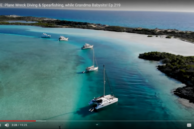
The Turks and Caicos are two separate island groups, with Turks being my favorite by far. But when traveling from the Bahamas, you will arrive in the Caicos Island group first, and with Providenciales—simply called “Provo”—being the tourist and commercial center of the country, this is a good starting point. You have the choice of staying in marinas on the north and south side of the island, or you can anchor in well-protected Sapodilla Bay. Each marina will help you clear customs, and if you stay in Sapodilla Bay, you can walk to the office in the South Dock complex.
EXPLORING THE CAICOS
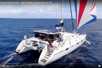
The Caicos are low-lying islands arranged in a crescent shape on the north side of a large sand bank, which is almost 60 miles across and no more than 20 feet deep. Even though there is a fair amount of land area, the only places you can take a cruising boat are Provo, West Caicos and South Caicos. When I arrived a week earlier as a singlehander aboard Guiding Light, my 1998 Lagoon 410, in order to pick up a friend on Christmas Eve, I explored the island and the town of Provo. While I waited for my friend to arrive, I walked to the top of Sapodilla Hill to take in the view and see the historic rocks where sailors have been carving their names since the late 1600s. Grace Bay on the north shore is where the best beaches and resorts are—it’s definitely worth a trek across the island to spend time laying on the soft sand, playing in the surf and snorkeling the fringe reef. I noticed a lack of protection on this side, as the wind was blowing 20 to 25 knots and the beach was being pounded, even with the protection of the barrier reef. At the same time, Sapodilla Bay had calm waters with a slight swell making it around the point. Other sites to explore on Provo are the Cheshire Hill sugar plantation (a national historic site) and a working conch farm.
One thing that amazed me was how expensive the taxis were on the island. They wanted $35 for a trip to Sapodilla Bay from the airport, which is less than four miles. Instead, I got around the island by walking, riding my bicycle (be careful as there are no bike lanes) and catching the local version of a jitney, which involves raising one’s hand, hopping in a local’s car when they stop, and giving them a couple bucks to take you where you want to go. You can also contact South Side Marina if you need any help on the island. They run the cruiser’s net, host a weekly BBQ and are a great source of information.

The day after Christmas, the wind died down from 20 to 25 knots to 10 to 15 knots, but it was still coming from the direction we were headed, so we filled up with fuel and motored across the Caicos Bank. We spent the night anchored out in the middle of the bank, where we had no protection. It was bumpy, but manageable. The next morning, we arrived at the easy-to-enter and well protected South Caicos harbor and had lunch ashore before walking to the Boiling Hole, which is a hole from the middle of the island’s salt pond to the ocean. More than 100 years ago, the locals built a wall with gates around it and used the salt water to feed the salt producing flats. We found it a fascinating look into the past, when salt was the entire economy here and in the Turks Islands. After visiting the hole, we had a great time snorkeling on the protective reef and saw a turtle nested under a ledge, among other things.
One of the top things I wanted to do was visit the 10 to 40 foot deep Endymion wreck (considered to be one of the top 10 wreck dives in the world) at the south end of the Turks Bank, so we motored 25 miles, with the wind still on the bow, across the blue water passage to the coordinates provided in the Explorer Charts. I love these charts and used them extensively throughout the Bahamas. They were always completely accurate—except this time. We did not find the wreck, and when I got coordinates from a local dive shop we were more than a mile off. If you want to visit the site, the correct GPS coordinates for the Endymion are 21° 06.91N, 071° 18.469W. Once we gave up the search for the wreck, we sailed to Big Sand Cay, which is basically a giant sand dune with a non-working light on it. We reveled in the simplicity of this island. The bay southwest of the bluff with the light is 13 to 18 feet deep, with gorgeous white sand and no coral heads to worry about. We stayed longer than planned, as the island made up for not seeing the wreck. If you are going to Luperon, this is a great jumping off point.
AT HOME IN THE FRIENDLY TURKS
After another trip ashore in the morning, we sailed north on the edge of the Turks Bank, with only 40 feet on the starboard side and 1000+ feet on the port side, to Salt Cay. As the name implies, this was one of the most important salt producers in the world. We anchored in more than 20 feet among sand and rock just south of the small boat harbor. If you visit, do not anchor closer than this, because the underwater wall is so steep the beach was being pounded by the surge while we were swaying gently under the swell. For the same reason, use the protection of the small boat harbor to land your dinghy.
The first thing you should do when you arrive is pop into Porter’s Island Thyme Pub. Here, Porter and Haidee will give you the lowdown on the island. They put us in touch with Tim, who is the seventh generation from his family to live on Salt Cay. He gave us a tour of his family’s home, the White House. For us, this was the highlight of the island—we got to see inside the most successful salt plantation house, which was built in 1740. The living quarters are on the top floor and the bottom housed four warehouses to store salt. We found the architecture and antique furniture fascinating, particularly a traditional Bermuda-style roof made with stone ship ballast.
The next day, we did the four walking tours listed on a pamphlet provided by Porter. We saw practically the entire island, with some of the highlights being pirate graves, a cannon with a great view, ruins on the tallest hill, a historical list of buildings in town, and the old Benevolent Society, where there was a coffin inside.

After several days on Salt Cay, we set sail again and went north seven miles to Grand Turk Island. Even though it is far removed from the hustle and bustle of Provo, this has been the capital of Turks and Caicos since the mid 1700s. The most talked-about site is the National Museum, where the entire first floor is devoted to the oldest shipwreck in the Americas and dates from 1513— just 21 years after Columbus’ first voyage. Later, we took a long walk to the northern point of the island and viewed the lighthouse responsible for warning ships of the reef extending to the northeast. We also visited the Salt Museum, which consisted of displays and a 20-minute documentary.

The last thing we did was get in one more snorkel. This time we picked up a dive buoy behind the boat and swam along the edge of the wall. Like the Caicos Bank, the Turks Bank is a shelf about 20 feet deep that drops off to thousands of feet within swimming distance. I swam down and followed the drop-off to a depth of around 40 feet. We had a blast and spent a good hour or two in the water before becoming exhausted and going back to the boat to prepare for our three-day crossing to the Virgin Islands.

If you are ever close to these islands, do yourself a favor and plan a visit. Make sure you spend plenty of time on the Turks side of the country. The best time of year is February through March, when the humpback whales migrate here for the winter. I am told they were spotted two days after we left. Aside from all the fantastic sights on land, the reefs and wall are within half a mile of the beaches, so there is plenty of SCUBA diving, snorkeling and beach combing to keep you busy. The only disadvantage is the lack of protected harbors (outside of Sapodilla Bay), making the anchorages open roadsteads. I have also been told the entrance fee into the Turks & Caicos has been raised to $300, so check that out before you go.

If you plan to reach the Eastern Caribbean by way of the Bahamas, the Turks and Caicos are a must-see before heading south. Replete with fascinating historical sights, beautiful beaches and friendly locals, you will not be disappointed with all these islands have to offer. Just make sure you build enough time into your cruising itinerary—you may not want to leave.


After cruising the Gulf Coast, East Coast and Bahamas, Shane C. McClellan has stopped in the Virgin Islands, where guests can charter with him. Check out www.svGuidingLight.com to read his weekly blog, watch travel videos, and learn about his boat.
